‘The book that most changed the scientific world, after Darwin’s Origin of Species, is Rachel Carson’s Silent Spring.’ David Attenborough1
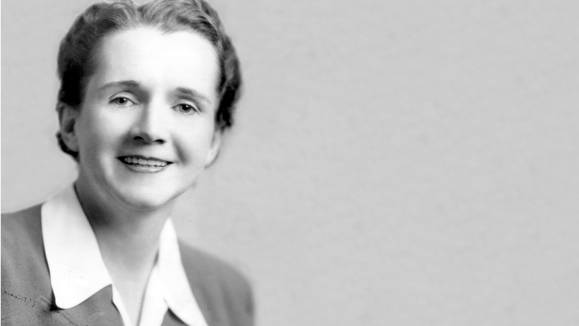
I first read Rachel Carson’s Silent Spring 2 as a teenager, soon after it was published in the UK, and it opened my eyes in several ways. It helped explain why I never saw any birds of prey other than owls and kestrels. It gave me a far clearer understanding of how ecosystems work, and how human interference with any element of them can upset the whole system. And I also realised that complex and controversial scientific ideas can be presented in ways that are accessible to the wider public – and can lead to major change, even in the face of powerful vested interests.
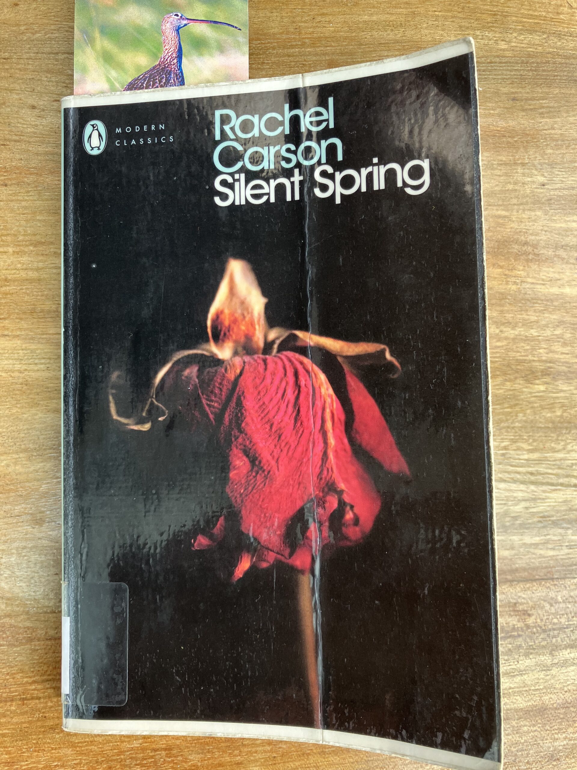
Silent Spring was ground breaking in several ways. Firstly, Carson’s immense talent as a writer meant that she could synthesise a diverse range of research sources into the impacts of pesticides and blend this scientific knowledge with more anecdotal accounts to create a coherent and highly readable book which immediately found a wide public – over 100,000 copies of the book sold in its first week. This quote is typical of her writing:
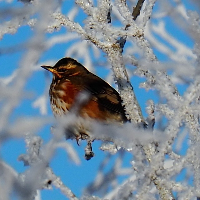
‘Over increasingly large areas of the United States, spring now comes unheralded by the return of the birds, and the early mornings are strangely silent where once they were filled with the beauty of bird song.’
Secondly, she understood the intimate connections between all members of an ecosystem…
‘The earth’s vegetation is part of a web of life in which there are intimate and essential relations between plants and the earth, between plants and other plants, between plants and animals.’
…and how damaging these connections can lead to unforeseen problems:
‘We spray our elms and the following springs are silent of robin song…because the poison travelled, step by step, through the elm leaf-earthworm-robin cycle.’
With considerable foresight she understood that it was not just insecticides that can put birds and animals at risk, but also the herbicides which, by killing weeds, can reduce invertebrate populations and thereby upset the whole food chain with wide-ranging consequences both for wildlife and for humans:
‘Clean cultivation and the chemical destruction of hedgerows and weeds are eliminating the last sanctuaries of pollinating insects and breaking the threads that bind life to life.’
Thirdly, she made the case for the precautionary principle: that new chemicals should be more thoroughly tested for their environmental and public health impacts before they are made widely available. Her book led directly to a government ruling that ‘no pesticide be used where there existed a reasonable doubt as to its environmental effects’3.
‘Nature has introduced great variety into the landscape, but man has displayed a passion for simplifying it. Thus he undoes the built-in checks and balances by which nature holds the species within bounds.’
As the book approached publication, Carson wrote that she felt it ‘should add up to pretty overwhelming indictment of what man is doing to the earth’4 and that ‘the beauty of the living world I was trying to save has always been uppermost in my mind’5. On reading the draft, the author E B White wrote to her ‘I’m unable adequately to express my gratitude to you for attempting to decontaminate this lovely world, and when the thrush sings in my woods again (and I’m sure he will) I will think of you every time, and give thanks.6‘
Upon publication, Carson was subject to immense abuse from the chemical industry. She was labelled an alarmist, a fanatic and a hysterical spinster who had ‘overstepped her place as a woman’7. Despite these attacks, she continued to present her case clearly and calmly, while having to deal with the final stages of a cancer that would kill her within two years of the publication of Silent Spring.
Despite the attacks from the pesticide industry her book had long term impacts. It began a public debate about the danger of pesticides such as DDT and other ‘organochloride’ insecticides like dieldrin and kick started the slow process that led to a US ban on agricultural use of DDT in 1972, ten years after its publication. By then DDT was already banned in Hungary, Norway, Sweden and Cuba, but it took until 1984 before a UK ban came into force and 2004 before a worldwide ban and DDT is still used in India and some African countries, and controversially as part of some anti-malarial programmes.
Silent Spring also stimulated the growth of the environmental movement in the US and elsewhere. In the US it led to legislation such as clean air and clean water acts and the eventual establishment of the Environmental Protection Agency.
Recently I thought I should revisit the book, and immediately the introduction felt just as relevant today as when she wrote it over sixty years ago. Thanks to her work, dangerous insecticides like DDT have been largely banned. However, the pesticide industry has carried on concocting powerful poisons that continue to threaten both our environment and human health, with the complicity of governments.
[We are] challenged as we have ‘never been challenged before to prove our maturity and our mastery, not of nature, but of ourselves.’
Between 2019 and 2022, 236 derogations were given to 14 pesticide substances across the EU; almost half of these were for neonicotinoids which pose a high risk to both wild bees and honeybees.8 In the UK the government has repeatedly waived restrictions on neonicotinoids9. In France the 2025 Loi Duplomb sought similarly to relax bans on these pesticides, despite immense public opposition.
Pesticide use continues to grow worldwide – research in the UK shows that the area of land treated with pesticides and the number of applications have both increased over the last thirty years10. These pesticides continue to affect wildlife; a large-scale study published in late 2025 demonstrated that ‘the use of pesticides has a strong negative impact on bird abundance in agricultural landscapes’ and that ‘that reducing pesticide use is necessary to mitigate the current loss of farmland biodiversity’11. Another study of the threatened farmland species, grey partridge, showed how ‘chronic exposure to pesticide residues, even at low doses… had detrimental consequences on offspring’ and ‘might partly explain the decline in wild grey partridge populations’12.
There is growing evidence that pesticides may have unexpected impacts that are not revealed during testing. The cocktail of chemicals applied to farmland can combine to produce more damaging impacts than the individual pesticides alone13. Another recent study revealed that pesticides can be transported in aerosol form by clouds over considerable distances and deposited with rain14.
Pesticides also continue to damage human health, particularly affecting those who work in agriculture and those who live close to sprayed farmland. For example, one study ‘corroborated the evidence that pesticides in vineyards contribute to mortality from brain cancer among farmers’15 while another found raised levels of leukaemia among children living close to vineyards16.
Moreover, Carson’s legacy extends more widely than the chemicals that were the main subject of her book, and I wonder how she would feel if she were still alive today. Her words: ‘Future generations are unlikely to condone our lack of prudent concern for the integrity of the natural world that supports all life’ ring even more true in a world facing global warming, pollution of the oceans and mass extinction.
- David Attenborough, 2014. See here. ↩︎
- Rachel Carson (1962). Silent Spring, Houghton Mifflin ↩︎
- Quoted from Linda Lear’s biography Rachel Carson: Witness for Nature (Allen Lane, 1997). The ruling was issued by interior secretary Stewart Udall in 1964. ↩︎
- Letter to William Shawn, editor of the New Yorker (20/7/1961) ↩︎
- Letter to Lois Crisler (8/2/1962) ↩︎
- Letter from E B White (24/8/1962) ↩︎
- Linda Lear (1999). Afterword to the Penguin Classics edition of Silent Spring ↩︎
- PAN Europe, 2023, Banned pesticides still in use in the EU, Pesticide Action Network Europe. See here. ↩︎
- The UK Conservative government allowed derogations of the neonicotinoid Thiamethoxam for four years in a row from 2021 to 2024. The new Labour government promised to ban it and refused a further derogation in 2025. ↩︎
- Soil Association/Pesticide Action Network UK (2019). The cocktail effect. See
here. ↩︎ - Monnet A-C, Cairo M, Deguines N, Jiguet F, Vimont M, Fontaine C, Porcher E. 2026 Common birds have higher abundances in croplands with lower pesticide purchases. Proc. R. Soc. B 293: 20252370. See here. ↩︎
- Agathe Gaffard, Olivier Pays, Karine Monceau, Maria Teixeira, Vincent Bretagnolle, Jérôme Moreau, Feeding on grains containing pesticide residues is detrimental to offspring development through parental effects in grey partridge, Environmental Pollution, Volume 312, 2022, 120005, ISSN 0269-7491,https://doi.org/10.1016/j.envpol.2022.120005 ↩︎
- Soil Association/Pesticide Action Network UK (2019). The cocktail effect. ↩︎
- Bianco A, Nibert P, Wu Y, Baray JL, Brigante M, Mailhot G, Deguillaume L, Vione D, Cabanes DJE, Méjean M, Besse-Hoggan P. Are Clouds a Neglected Reservoir of Pesticides? Environ Sci Technol. 2025 Oct 14;59(40):21579-21588. doi: 10.1021/acs.est.5c03787. Epub 2025 Sep 8. PMID: 40920485. ↩︎
- Viel, J. F., Challier, B., Pitard, A., & Pobel, D. (1998). Brain Cancer Mortality among French Farmers: The Vineyard Pesticide Hypothesis. Archives of Environmental Health: An International Journal, 53(1), 65–70. https://doi.org/10.1080/00039899809605690 ↩︎
- Mancini M, Hémon D, de Crouy-Chanel P, Guldner L, Faure L, Clavel J, Goujon S. Association between Residential Proximity to Viticultural Areas and Childhood Acute Leukemia Risk in Mainland France: GEOCAP Case-Control Study, 2006-2013. Environ Health Perspect. 2023 Oct;131(10):107008. doi: 10.1289/EHP12634. Epub 2023 Oct 18. PMID: 37850750; PMCID: PMC10583703. ↩︎